Nearest Airport – Mangalore & Bangalore
Nearest Railway station – Sakleshpur
Sakleshpur is strategically located on the Mangalore – Bangalore highway.
Bangalore – nelamangala – kunigal bypass – yediyur – chanarayanapatna – Hassan bypass – sakleshpur- hanbal – devaldekere – margunda (private parking for guests & travel horse back or pick up jeep) – betta byreshwara temple on hill top ( road end )-11 kms off-road hill ride – reach HULIVANA.

Jenkal betta – Sakleshpur’s highest peak & the 3rd highest peak of the state.
The same hill surrounds HULIVANA on all 3 sides. A dead end.
The last resort …indeed!
“HULIVANA” – folklore olde, has it that this deep- dead end,
spot in the forest was a coven for tigers ages ago.
Hulli meaning tiger & ba-nna is, to gather .
Not surprising! As we retained its own infamous name.
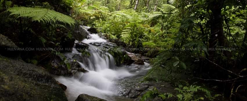
A spring pond, wide tree canopy, meandering brooks, crisscrossing streams & a small waterfall.
Experience a lil swatch of the evergreen sholas at HULIVANA !
A lost resort!
The Western Ghats have been designated as one of the worlds 18 bio diversity hotspots & short listed (2011) by UNESCO to be included under its world heritage sites.
It is a chain of hills extending over 1600 kms along the West Coast of Peninsular India, housing one of the richest assemblages of flora and fauna on earth.
The biological richness can best be understood as 27% of all species of higher plants (4,000 of 15,000 species) recorded in the Indian sub continent are found here.
It is here that frogs reach their highest diversity, with over 100 species.
Endemism is a natural feature of the Western Ghats and this is exhibited not only among frogs, but also among plant species, nearly 1800, are endemic The range is home to at least 84 amphibian species, 16 bird species, seven mammals, and 1,600 flowering plants which are not found elsewhere in the world.
Non endemic species counts more than 5000 species of flowering plants, 139 mammal species, 508 bird species and 179 amphibian species.
At least 325 globally rare species occur in the 160,000 km² area of the Western Ghats and was declared an ecological hotspot in 1988 through the efforts of ecologist Norman Myers.
The average elevation is around 1,200 metres (3,900 ft) & its highest peak Anai mudi is 8842 ft.
Salher (Maharashtra), Kalsubai (Maharashtra), Mahableshwar (Maharashtra), Sonsogor (Goa), jenkal beta ( Karnataka ) Kemmangundi (Karnataka), Tadiandamol(Karnataka), Mullayanagiri (Karnataka), (bababudangiri range) (karnataka), Kudremukh (Karnataka), Pushpagiri (Karnataka), Kumara Parvatha (Karnataka), Doddabetta (Tamil Nadu) & Anai Mudi (Kerala).
The western ghats forms the catchment area for a complex network of river systems & draining it for almost 40% of India
Its one of the three watersheds of India, feeding the perennial rivers of India. Important rivers include the Godavari, Krishna, and Kaveri. The larger tributaries include the Tunga River, Bhadra river, Bhima River, Malaprabha River, Ghataprabha River, Hemavathi river, Kabini River. In addition there are several smaller rivers such as the Chittar River, Manimuthar River, Kallayi River, Kundali River, Pachaiyar River, Pennar River, Periyar and the Kallayi River.

Hulivana listed amongst the 20 Best Winter Escapes
